
Goebel, Champlain, Burgess, Hillsboro, Grafton, E. Mason, Strafford, Sullivan, Coos, Carroll, Cheshire, Merrimack, Devens, King and Standard Streets
Although there was some development on the east side of the Androscoggin in Berlin before 1861, it did not reach much further south than the 12th Street Bridge — roughly the location of the Sam Paine Bridge at that time. Because it was difficult to reach, major development on the east side to the south awaited three linked developments, the construction of the Concord & Montreal Railroad (1891-3), the construction of the Burgess Sulphite Mill (1892) and the building of the Mason Street Bridge (1893). Prior to the completion of the Mason Street Bridge, there was already a connection to the Burgess Mill “in the form of steel railroad bridges and the Berlin Mills Railway.” (Tardiff, Berlin Daily Sun ND “East Side and More”) Land on the east side was subdivided immediately thereafter, beginning in 1893. The bulk of the land was part of two large plats which were additions to Berlin Mills, controlled by the Brown family. The area closest to (and behind) the depot was owned by the Greene Aqueduct and Land Company.
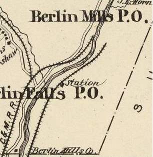
The 1892 Hurd Map shows the railroad on the east side but likely predates construction of the station which is shown on the wrong side of the tracks.
Poof Tardiff wrote this on the development of the Berlin Mills land:
By 1893, citizens of Berlin could cross this bridge [Mason St. Bridge] with horse and buggy and make their way to the new passenger station (Depot Restaurant today) on the other side of the river. With this in place, the Berlin Mills Company started selling some of its land around the depot and near their mill. At this point a man named Gershon Bickford got involved. Originally this area was called the “Berlin Mills Addition” and then “Cottage City,” before eventually being called the “East Side.”
… Bickford had secured from Herbert Brown, the manager of the Berlin Mills company, the sale of these lots. Mr. Bickford was working with surveyor E.McCoy Macy… who had just finished the survey. They recorded the lots and named the streets after New Hampshire counties.
…The lots that Bickford had were selling at a fast rate for two and three hundred dollars, with eight dollars down and a monthly installment of five dollars until fully paid.
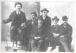
Gershon Bickford, Second from the Right (BCCHS)
In order to get the building started on this side of the river, Bickford built the first two houses and they sold right away. A two story, six room house with a lot sold for $1,200. In order to buy this though, one had to put 100 dollars down and then had to pay the balance in ten months. (Berlin Daily Sun, “East Side and More”)
The Greene Aqueduct and Land Company platted their 94-lot, eight block triangular area of land in 1893 and auctioned off at least some of the house lots in June, 1894. The advertisement for the auction touted the convenience, beauty and natural drainage of the East Side, as well claiming that 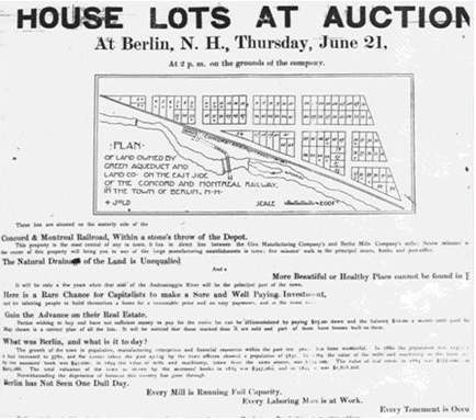
It will be only a few years when that side of the Androscoggin River will be the principal part of the town. Here is a rare chance for capitalists to make a sure and well paying investment, and for laboring people to build themselves a home for a reasonable price and on easy payments and at the same time gain the advance on their real estate.
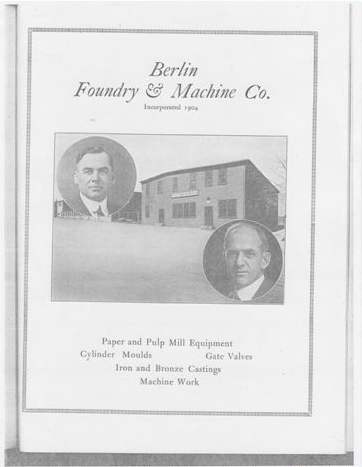
George Harkins and John Mahern founders of the Berlin Foundry & Machine Co.(“ Illustrated Industrial Edition of Berlin, New Hampshire”)
By the early years of the century there were already houses on the East Side. Although there wasn’t sufficient building to warrant coverage in the 1901 Sanborn map (aside from the Burgess Plant) by the 1905 Sanborn there is extensive development, including the Berlin Foundry & Machine Co. located off of Goebel.
Goebel Street was named for an early resident of the street. John Goebel was a German immigrant who owned a local mill/business on Mechanic Street on the west side (selling hay, grain, flour, feed, grass seed, salt, etc.) Around the turn of the century, the area around Goebel became a small enclave of German residents. In the first decade of the 20th century Devens Street was known as German Street (1900 Census, 1909 Sanborn). In the wake of World War I, the street name was changed to Devens. (It is labeled “Devens (German)” on the 1920 Sanborn Map.) The 1900 census listed roughly eight German families in the Goebel/Devens neighborhood and the number remained about the same in the 1920 census.
Another even smaller ethnic enclave was located around King Street. The 1920 Sanborn Map labels Cheshire Street between Grafton and Coos as “Italian Street.” Later, in the 1928 Sanborn the street appears as “King Street (Italian).” At least by the 1930s there were few Italian families in residence in the area.
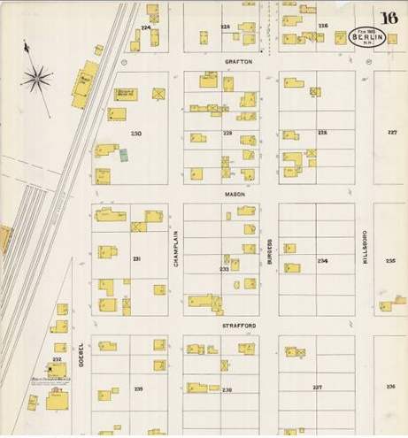 Sanborn 1905 |
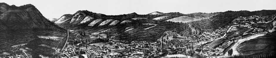
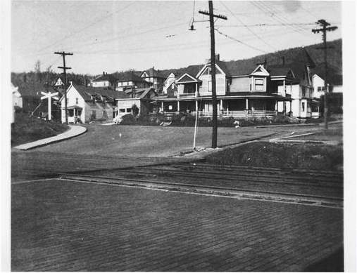 View of the east side (far side of river) from Mt. Forist. |
 USGS 1942 |
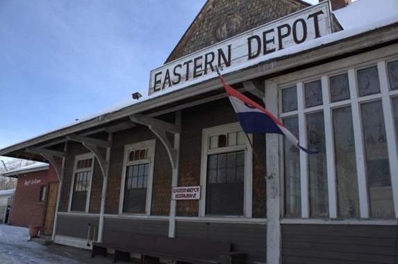 The Concord & Montreal Railroad Station |
 Follow